Cherokee County NC Property Appraiser – Search Property Records Online
In Cherokee County, North Carolina, there are 35,237 parcels available for public lookup. You can search property records using the parcel number, owner name, or property address. For Parcel ID searches, enter numbers exactly as listed to access ownership, tax, and assessment details quickly.
Property Tax Calculator
Calculate Any County Property Tax in North Carolina
Transfer Fee Calculator
Calculate Any County Property Transfer Tax in North Carolina
Property Tax Rates and guide
North Carolina All Counties Property Tax Rates and guide
Counties Maps and Zoning
North Carolina All Counties Maps and Zoning Guide
All NC Counties Property News
North Carolina Property News and Trend Updates By County
The Cherokee County Property Appraiser maintains updated parcel and building datasets for public property research and transparency. The county currently manages 35,237 parcels and 31,140 matched structures, supported by aerial imagery collected between 2010 and 2022. Address databases were refreshed in 2026, identifying 26,999 secondary addresses. Zoning classifications have been standardized across 35,236 parcels, helping ensure consistent property valuation, accurate tax assessments, and reliable land-use information throughout Cherokee County.
Cherokee County, North Carolina Property Overview – 2026
Cherokee County includes 18,956 residential properties and 891 commercial properties. The typical single-family residence averages 37 years old with approximately 1,455 square feet of living space. During 2026, the county recorded 57 residential sales, while only 0.83% of homes were considered seriously underwater. The effective property tax rate stands at 0.29%, reflecting relatively affordable ownership costs.
Residential Properties
18,956
Commercial Properties
891
Avg. Home Age Single Family
37 Years
Avg. Square Feet Single Family
1,455 sq. ft
Residential Sales 2026
57
Homes Seriously Underwater
0.83%
Residential Sales past year
863
Rich Homes percentage
25.38%
Effective 2026 Property Tax
0.29%
Total Foreclosure Filings 2025
3
Nearby Counties –Cherokee County
Cherokee County, North Carolina is surrounded by Clay, Graham, Towns, and Macon counties, offering regional connectivity, shared services, and access to natural attractions, supporting residents, visitors, and local economic activities.
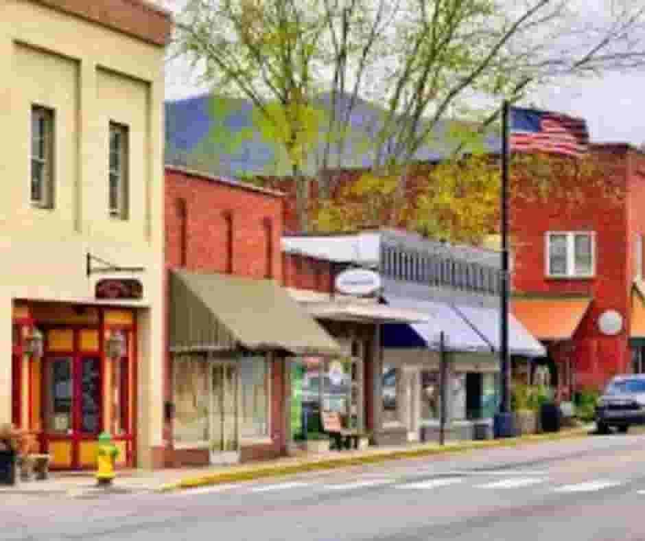
Top Cities in Cherokee County, North Carolina
The leading communities within Cherokee County include Murphy, Andrews, and Marble, which serve as the county’s main residential and commercial centers. These towns combine mountain living, local business activity, and established neighborhoods, contributing significantly to parcel management, zoning oversight, and property assessment operations handled by county officials.

Murph
14889 Parcel
Andrews
2850 Parcel

Marble
1870 Parcel
Cherokee County NC Property Search Tool – 4 Easy Search Methods
Our Cherokee County, North Carolina Property Search Tool allows users to access property records online at no cost. Search using owner name, parcel number (PIN), property address, or city name. Instantly review ownership history, tax data, sales records, and full parcel details within seconds.
Search By Owner Name
Use a property owner’s name to locate records throughout Cherokee County North Carolina quickly.
Search By Address
Enter the property address to access parcel data and ownership information in Cherokee County.
Search By Parcel PIN
Search using the parcel identification number for accurate Cherokee County property record results.
Search By City Name
If limited details are available, search using a Cherokee County city name within address fields.
Cherokee County NC Property Search Tool Provides Information
The Cherokee County North Carolina Property Search Tool delivers detailed real estate insights with every lookup. Users can search by owner name, parcel number, or address to view ownership records, land values, tax assessments, zoning details, and official county property information for accurate research decisions.
Parcel Number
A unique identification code assigned to each property, helping users locate ownership details, tax records, parcel maps, and official assessment information easily.
Owner Name
Displays the legally registered property owner according to public records, allowing users to verify ownership, confirm title details, and identify responsible parties.
Full Site Address
Shows the complete physical location of the property, including street information, enabling accurate identification, navigation, and property verification for records or services.
Site Address City
Indicates the city where the property is officially located, helping users understand jurisdiction boundaries, municipal services, and local administrative authority information.
Site Address Zip
Provides the postal zip code assigned to the property location, assisting with mailing accuracy, geographic identification, and regional classification within official databases.
Mailing Address
Lists the official contact or billing address of the property owner, used for sending tax notices, legal correspondence, and important property-related communications.
Land Value
Represents the assessed market value of the land only, excluding buildings or improvements, used primarily for taxation and property assessment calculations purposes.
Improved Value
Shows the assessed value of structures and improvements built on the land, including houses, buildings, or additional property developments affecting total valuation.
Parcel Value
Displays the combined taxable value of land and improvements, helping determine property taxes, assessments, and overall estimated worth recorded by local authorities.
GIS Acres
Indicates the total land size measured through Geographic Information System mapping technology, providing accurate acreage calculations for planning, valuation, and property analysis.
Structure Year
Shows the year the main structure or building was originally constructed, helping users understand property age, historical context, and potential maintenance considerations.
Last Sale Date
Records the date when the property was most recently sold or transferred, useful for tracking ownership history, market trends, and transaction timelines.
Tax Parcel Use Code
Defines how the property is classified for taxation purposes, such as residential, commercial, agricultural, or industrial, affecting tax rates and regulations applied.
Full Legal Description
Provides the official legal wording describing property boundaries and dimensions, used in deeds, surveys, and legal documentation to precisely identify the parcel.
County Name
Identifies the county government responsible for maintaining property records, assessments, taxation, and administrative oversight related to the specific property location.
Cherokee County & North Carolina City Tax Rates and Population Data
Cherokee County and its towns property tax and demographic overview, including estimated population, land area, millage tax rates, and median property tax bills for comparison.
| City / Town Name | Total Population (Est. 2025) | Area (Sq Mi) | Millage Rate (per $100) | Median Tax Bill (Est.) |
|---|---|---|---|---|
| Cherokee County (Base) | 30,373 | 455 | $0.6100 | $1,176 |
| Murphy (Town) | 1,713 | 2.6 | $1.0300 (Combined) | $1,390 |
| Andrews (Town) | 1,785 | 1.6 | $1.1300 (Combined) | $1,605 |
| Unincorporated Areas | ~26,000 | 450 | $0.6100 + Fire Dist. | $900 - $1,200 |
FAQs
How can I search property records in Cherokee County, NC?
You can search Cherokee County property records online using owner name, parcel number, or property address through the county property search or GIS mapping system.
What is the population of Cherokee County, North Carolina?
Cherokee County has a small rural population with steady growth, offering quiet communities, mountain living, and affordable housing compared to larger North Carolina counties.
How does the Cherokee County NC GIS map help property owners?
The Cherokee County GIS map allows users to view parcel boundaries, zoning information, aerial imagery, land details, and tax assessment data interactively online
Are there good schools in Cherokee County, NC?
Cherokee County Schools provide public education across multiple grade levels, serving local communities with academic programs, athletics, and student support services.
Where can I find homes for sale in Cherokee County, NC?
Homes for sale in Cherokee County can be found through real estate websites, local agents, and county property listings showing available residential and land properties.